I recently watched Vitalik Buterin's talk about his "fork" of e/acc[1] dubbed d/acc, or decentralized accelerationism.
In it, he makes the following case[2]:
This idea is deceptively sexy to me; It explains my current worldview a little too well. For example, two of the most successful authoritarian countries in the modern era, China and Russia, have similar defensibility issues. Both China and Russia bore the brunt of nomadic horse archers (Huns, Mongols, etc) as they both have large portions of their border which are steppe a.k.a. the "home of the nomadic horse archer". The crux of the theory is that despotic strongmen leaders are preferable to the wrath of nomadic horse archers[3]. Therefore less defensible regions developed more authoritarian cultures, whereas the spoiled defensible areas developed sissy values like "freedom of speech" and "democracy".
In Vitalik's case, I would like to investigate his second claim:
Classically liberal culture is correlated with defensible borders.
I am almost positive this is an area already studied by statisticians and historians. But in typical software engineer fashion, as a matter of practice I want to investigate this claim starting from first principles.
The approach I took was as follows:

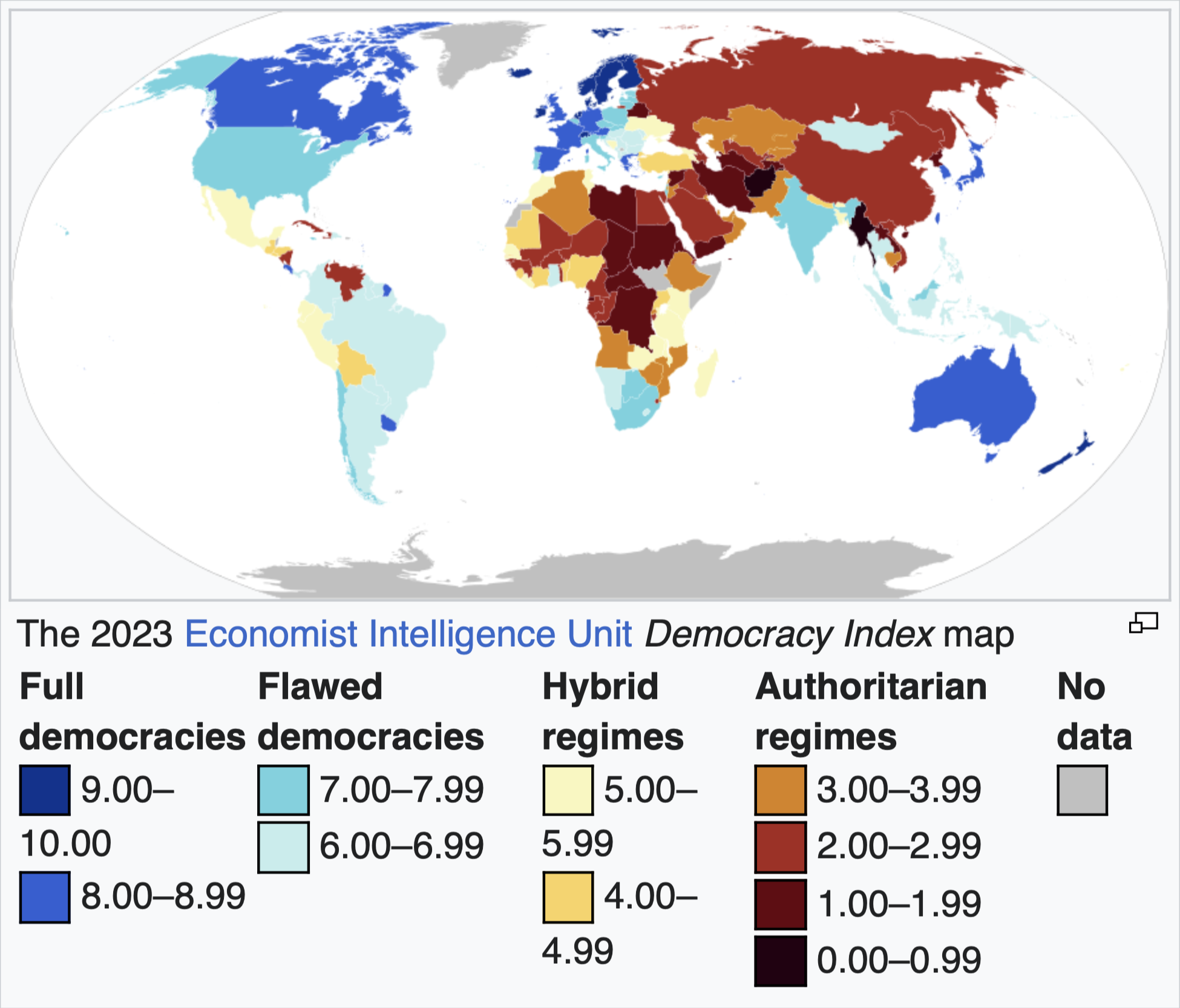
I used the Economist Democracy Index as my measure of democracy. This is a survey of expert assessments of the politics of countries around the world. The questions are grouped into five categories:
Each country has a score between 0 and 10, where 0 is 1984 and 10 is the pinnacle of democracy.
Defensibility is complicated to say the least. I'm going to limit the factors I consider here for this reason. I chose the two largest defensibility factors for simplicity.
And I combined those two geography shapefiles with a political border shapefile[7].
I needed to turn those geographical shapefiles into a measure of defensible borders. I did this in the following way.
The problem with borders is that they are quite literally infinite in length[8]. To deal with this, I did two things:
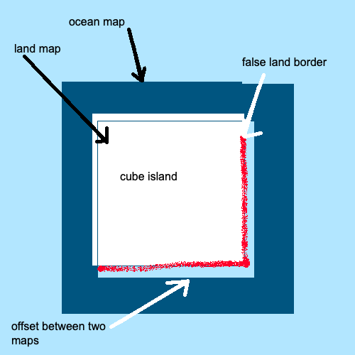
This reasulted in simplified maps that looked something like this (ignore the red for now!):

For each segment of each political border, I marked it as either coastline, mountain, or neither.
For each segment of the political border, there is a coordinate for its midpoint. Every midpoint coordinate which intersects a mountain range is considered to have a mountain border.
I calculated the coastline somewhat similarly to the mountainlines. But with a few differences because:
The coastline map did not match directly with the political map. Meaning a particular coordinate which should be marked as coastline could be marked as a land border mistakenly.

I added some degree of tolerance into this calculation. I tuned it until qualitatively most of the land borders and coast borders looked "about right". Here is South Korea as an example. Red signifies land border, while grey is coastline.

For each country, I took the sum of the length of:
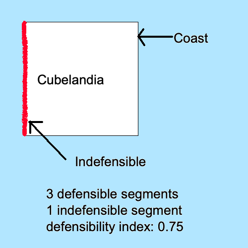
Using that I defined the Defensibility Index as the ratio between defensible border segments and indefensible border segments.

This gives every country a score between 0 and 1 where 0 means a completely landlocked country with no mountains. 1 is a country completely surrounded by coastline or mountains.
For all of the countries, I calculated the Pearson correlation between my defensibility index and the democracy index.

This resulted in a correlation coefficient of 0.40 and a negligible p value. This means there is a moderate correlation between defensible borders and democracy.
In hard-sciences a correlation of 0.40 is close to meaningless. But in the social sciences, this shows a decent correlation. Since culture and history are such complex subjects, even a slight correlation is meaningful.
This is pretty cool! Maybe I'll read the actual experts' papers on this subject now that I discovered this the hard way!
If you want to see my Python notebook, check it out on my Github[9].
Again, I'm just doing this for fun. There were many aspects I could have done better. Here are a few I thought of: